
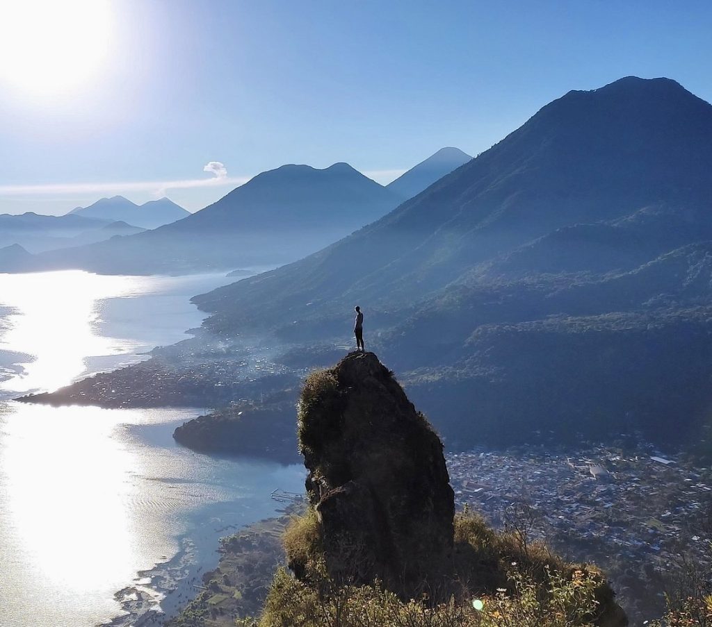
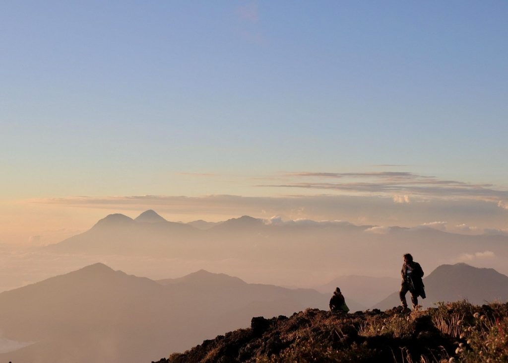
There is a moment on almost every summit hike at Lake Atitlán when the scale of this place finally lands. You stop. The caldera opens below you, the lake impossibly blue, three volcanoes across the water, and for a second you feel not like someone looking at a landscape but like a small part of something enormous that was here long before you and will be here long after. I’ve been coming to this lake my whole life, and that moment still gets me every time.
Atitlán has far more hiking than most people realize. The standard conversation stops at the Reserva Natural in Panajachel and maybe Volcán San Pedro, and both are worth doing. But there’s also a waterfall above San Lucas Tolimán that almost nobody visits, a shoreline trail between Santa Cruz and Jaibalito that local fishermen use every morning, a mirador above San Juan that gives you the lake to yourself at sunrise, and a three-day highland walk from Quetzaltenango that brings you to the water in one of the most dramatic arrivals I know. This guide covers all of it, organized by trail type. Find whatever fits your trip and go.
This guide is for
✓ Anyone trying to figure out which hike is worth getting up early for ✓ Travelers who want more than the standard Reserva Natural visit ✓ People deciding between volcano summits and village trails ✓ Birdwatchers hoping to spot a quetzal near the lake ✓ Serious trekkers considering the multi-day Xela-to-Atitlán route
AT A GLANCE
Every Hike at Lake Atitlán — Quick Reference
Use this as your starting point, then read the full section on whatever interests you most.
| Trail | Difficulty | Time | Starts from | Guide? |
|---|---|---|---|---|
| Volcán San Pedro | Moderate-Strenuous | 4-6 hrs | San Pedro La Laguna | Yes — required |
| Indian Nose Sunrise | Moderate | 2-3 hrs | Santa Cruz / San Pedro | Yes — required |
| Volcán Tolimán | Hard | 7-8 hrs / overnight | Santiago Atitlán | Yes — required |
| Volcán Atitlán | Very Strenuous | 8+ hrs | Near Santiago Atitlán | Yes — required |
| Waterfall Hike (San Pedro) | Easy-Moderate | 2-3 hrs | San Pedro La Laguna | Recommended |
| Catarata Sajbina | Easy | 25 min from town | San Lucas Tolimán | No |
| Tzununá Waterfall | Easy-Moderate | 40-60 min | Tzununá village | No |
| Cascadas Palopó | Easy-Moderate | 30-45 min | San Antonio Palopó | No |
| Santa Cruz to San Marcos trail | Moderate | 3-4 hrs | Santa Cruz La Laguna | Recommended |
| Ancestral Mayan Walk | Easy-Moderate | 2-3 hrs | Santa Cruz La Laguna | Yes (private tour) |
| Santa Cruz to Jaibalito trail | Easy | 1.5-2 hrs | Santa Cruz or Jaibalito | No |
| Lower Mayan Trail | Easy-Moderate | 2-3 hrs | Panajachel | Yes (guided tour) |
| Godínez to Santa Catarina Palopó | Moderate | 3-4 hrs | Godínez | Yes (Timoteo) |
| Hike above Panajachel | Moderate | 2-4 hrs | Panajachel | Yes (Timoteo) |
| San Juan La Laguna to Santa Clara | Moderate | 3-4 hrs | San Juan La Laguna | Yes (Timoteo) |
| Reserva Natural de Atitlán | Easy | 1-3 hrs | Panajachel | No |
| Cerro Tzankujil (San Marcos) | Easy-Moderate | 1-2 hrs | San Marcos La Laguna | No |
| Xela to Lake Atitlán (3-day trek) | Hard | 3 days | Quetzaltenango | Yes — required |
THE VOLCANO HIKES
Volcano Summits at Lake Atitlán
You start at 1,562 meters before you take a single step. Gain elevation through coffee farms and forest, and then the path opens and the caldera appears behind you. All of it at once. Three volcanoes across the water, the lake in the basin below, the air around you cool and still. What hits you isn’t just the view. It’s the feeling of being part of something that has nothing to do with you and everything to do with where you are. I’ve watched that arrive for other people and I’ve had it arrive for me more times than I can count. These hikes earn it.
All four volcano hikes here require a local guide, not as a formality but out of actual necessity. The trails are unmarked, the weather above 2,500 meters changes fast, and there have been robberies on these routes when people have tried to go without one. It’s not a risk worth taking when booking a guide through a registered operator costs very little and gets you someone who actually knows the mountain. Leave no later than 5 or 6 AM on any summit hike. Cloud cover usually rolls in between 9 and 11 AM and closes the views you came for.
WATERFALL HIKES
Waterfall Hikes at Lake Atitlán
The lake’s waterfall hikes are some of the best half-day options if you want to be moving through the landscape without the commitment of a full summit push. Some of them are established guided experiences; others are walks you just do on your own after asking a local to point you in the right direction. All of them are better in the morning.
Waterfall Hike from San Pedro La Laguna
I have a thing about waterfalls. Getting to one through forest and farmland, with the falls waiting at the end, makes for a morning that doesn’t feel like a consolation prize for skipping the volcano. The path above San Pedro runs through working coffee farms, corn fields, and fruit trees, and the guide’s knowledge of what you’re walking through makes the whole thing considerably more interesting than following a path alone. Bring shoes you can get wet. The waterfall hike from San Pedro takes 2 to 3 hours and fits comfortably into a morning.
Catarata Sajbina — San Lucas Tolimán
✨ ONE MOST PEOPLE HAVE NEVER HEARD OF
Also called Catarata La Escondida. Twenty-five minutes from the San Lucas Tolimán town center, Q15 entrance, cold clear water you can swim in. This one is worth the lancha ride from Panajachel.
In the municipality of San Lucas Tolimán, a waterfall drops through stone walls completely covered in dense vegetation. No construction anywhere around it, no crowds, no facilities. The water is cold and clear enough to swim. The approach is a 25-minute walk from town; ask locally for the path since there are no signs. Bring water shoes or grip sandals (the terrain is rocky), and a change of clothes because you’ll want to get in. San Lucas is a 40-minute lancha ride from Panajachel. Combining Catarata Sajbina with the village itself, or with the Tolimán volcano hike if you’re staying overnight, makes San Lucas worth treating as a proper destination rather than just a place you pass through. This trail isn’t currently on AllTrails; ask any local in San Lucas for the path to La Escondida.
Tzununá Waterfall
One of my favorite short hikes at the lake, and one that almost nobody does. From the Tzununá dock you walk uphill through the village, the paved road turns to dirt, the dirt turns to a rocky path. The trail takes you past an animal farm, through a tree nursery, across a small river a few times, over some boulders. You do a little birding along the way, cross some terrain that asks you to actually pay attention, and 40 to 60 minutes later you’re at a waterfall with views back across the lake and the volcanoes. It’s a proper little adventure for a morning. Ask any local in Tzununá to point you toward the falls. Wear hiking shoes, bring water, go early. This trail isn’t on AllTrails; directions from a local are your map.
Cascadas Palopó — San Antonio Palopó
A waterfall in the ravine above San Antonio Palopó, reached through terraced onion fields that climb steeply above the village. It’s a 30 to 45 minute walk from the village. The climb through the fields is part of what makes this worth doing: smallholder Tz’utujil Maya farming on volcanic terrain, the lake visible below you as you go up. Ask locally for the path. No entrance fee. Combine it with a visit to the village’s ceramics tradition and you have a full half-day on the eastern shore. Not currently on AllTrails; ask in the village for the trail to the falls.
Cascadas de Metzabal
A mountain waterfall above the lake in the San Pedro and San Juan area, known locally and not yet established on any tour platform or AllTrails. If you want to visit, ask around in San Pedro or San Juan for the current access route. Conditions and seasonal access vary, and this one needs local guidance to find.
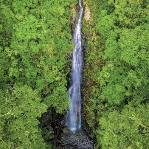
Metzabal waterfall near San Pedro la Laguna in lake Atitlán.
VILLAGE AND CULTURAL TRAILS
Village Trails, Shoreline Walks, and Cultural Hikes
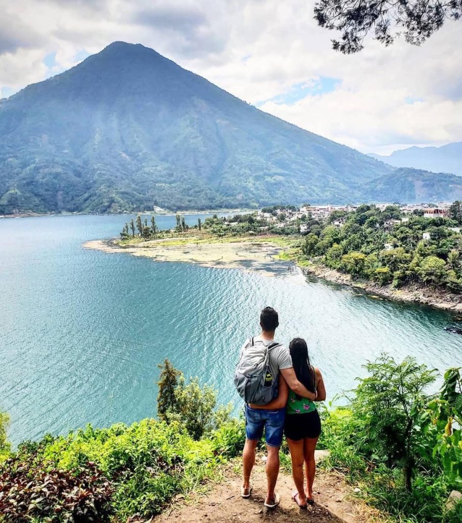
Some of the best walking at this lake isn’t the summit hikes. It’s the paths between villages on the northern shore that have connected these communities for centuries. You see a completely different Atitlán on foot than you do from the lancha. These trails are quieter, slower, and give you the lake at a pace where you actually absorb what you’re looking at.
Hiking Around Lake Atitlán: Santa Cruz to San Marcos
The western shore trail from Santa Cruz La Laguna through Jaibalito and Tzununá to San Marcos La Laguna is one of the great half-day walks at this lake. Three to 4 hours on paths that hug the cliff edge above the water, pass through tiny communities, and give you views that the boat passengers rushing past on the lancha route never slow down to see. The hiking around Lake Atitlán tour from Santa Cruz to San Marcos includes a guide whose knowledge of the communities you’re walking through turns a scenic walk into something considerably more meaningful.
Private Ancestral Mayan Walk: Santa Cruz to Tzununá
A private guided walk along the ancient paths between Santa Cruz La Laguna and Tzununá, routes that Kaqchikel Maya communities have used for generations to move between villages, tend their milpa fields, and stay connected across the northern shore. Walking these paths with a guide who can explain what you’re seeing and whose land you’re crossing changes the experience entirely. The Ancestral Mayan Walk between Santa Cruz and Tzununá is the kind of experience that stays with you, not because it’s dramatic but because it’s real in a way that a lot of things at this lake aren’t.
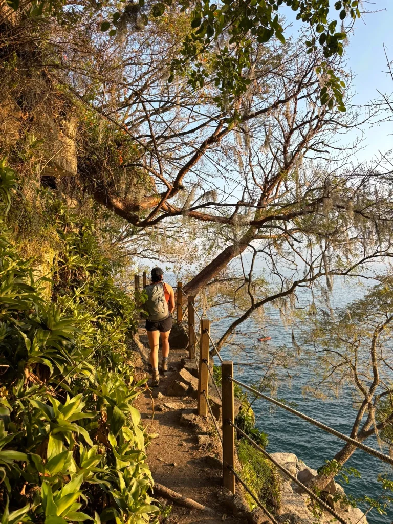
Santa Cruz to Jaibalito Shoreline Trail
This one you can do completely on your own and it will probably be one of the quieter, more beautiful walks of your trip. The path between Santa Cruz La Laguna and Jaibalito runs 1.5 to 2 hours on foot along routes used by local fishermen. Cliff-edge sections where the lake is directly below you and the three volcanoes are directly in front of you and there’s almost nobody else around. Start from either village dock, walk to the other, and take the lancha back. Easy terrain, no guide needed, no entrance fee. Go in the morning before the day boats start running. Trail map on AllTrails if you want to look at the route before you go.
Lower Mayan Trail from Panajachel
A guided 2-3 hour walk along ancient paths that connected the lake’s Maya communities long before roads existed. The guide’s knowledge of what you’re walking through, which families farmed which land, what the route meant to the communities on either side, how the lake looked to people who traveled these paths, is what makes this worth booking with a guide rather than attempting on your own. The Lower Mayan Trail hiking tour from Panajachel is one of the more culturally grounded experiences available on foot at the lake.
Godínez to Santa Catarina Palopó
Most people only know Godínez as the town they pass through in a shuttle window on the way to Antigua. A quiet, cool, pine-lined village high above the lake that barely registers before you’re past it. What they don’t know is that Godínez is the starting point for one of the most beautiful descents anywhere on Lake Atitlán.
The entrance to this trail is hidden in plain sight. Unless you’ve walked it with someone who knows it, you’ll pass right by. From the first steps, the lake opens up in a way that surprises even people who think they’ve seen every angle of Atitlán: Santiago across the water, San Antonio Palopó, all three volcanoes, Panajachel in the distance. I’ve taken guests along this trail many times, and every group has had the same moment where someone stops walking and says, “How is this not on every map?”
As you descend, daily village life moves around you. Farmers heading to their fields, kids walking home from school, women selling at the small market. No tourism infrastructure, no signs pointing the way. Partway down, just above Santa Catarina Palopó, the trail opens into a large farm field where a natural waterfall irrigates the crops year-round. Even in the dry season, when everything else turns brown and dusty, that field stays green. Every group stops here. Partly for the view of the village below, partly because it feels like a piece of the lake that very few outsiders ever actually find.
From there the path drops steadily toward the colorful houses and murals of Santa Catarina Palopó, where you can look for textiles and catch a tuk-tuk or lancha back. It’s moderate, not difficult. It stays quiet because people don’t know how to reach it. That’s exactly why it remains worth doing. This is a hike you do with Timoteo, who knows the trail and the villages it passes through. His contact is something I share with clients.
Cerro Tzankujil Nature Reserve, San Marcos
The nature reserve at the edge of San Marcos La Laguna has forest trails, a Mayan altar that is actively used for ceremony, and cliff jumping platforms at multiple heights above the lake. The main platform is 12 meters. Q20 entrance. The walk through the reserve is easy and anyone can do it. Whether you jump off the cliff is up to you. Go before 10 AM before the day-trip lanchas bring the crowds. Trail map on AllTrails, and my complete guide to San Marcos La Laguna covers the reserve in full.
Hiking above Panajachel: Village Life at the Top of the Mountain
From the center of Panajachel the trail climbs above the town and into a world most visitors never reach. At the top of the mountain are very small villages: most have one small store, children in the streets, women in the doorways, life moving at a pace that has nothing to do with the tourist economy below. The views on the way up are extraordinary, the lake dropping further below you with every step, the volcanoes slowly coming into full view. This hike is about what you find at the top, not just the view. It’s a glimpse into rural lake life that you won’t get from any lancha or market visit. Do this one with Timoteo, who knows those villages and can take you through them rather than just past them.
San Juan La Laguna to Santa Clara La Laguna
This is not the sunrise hike that San Juan is known for, and it’s completely different. Start in the village during the day, walk past the street art, climb to the mirador with its full panorama of the volcanoes and the lake, then continue up the mountain and over to Santa Clara La Laguna on the other side. The descent into Santa Clara is the part people don’t expect: a traditional village with no other tourists, life moving exactly as it does any other day of the week. If there’s a market, get juice and fruit. Look at the church in the main square. Take a tuk-tuk or chicken bus back. The whole thing takes 3 to 4 hours and leaves you with the kind of quiet that comes from spending an afternoon somewhere the visitor circuit hasn’t found yet. Timoteo leads this route.
COMBINATION ROUTES AND SPECIAL EXPERIENCES
Kayak and Hike, Birdwatching, and the Reserva Natural
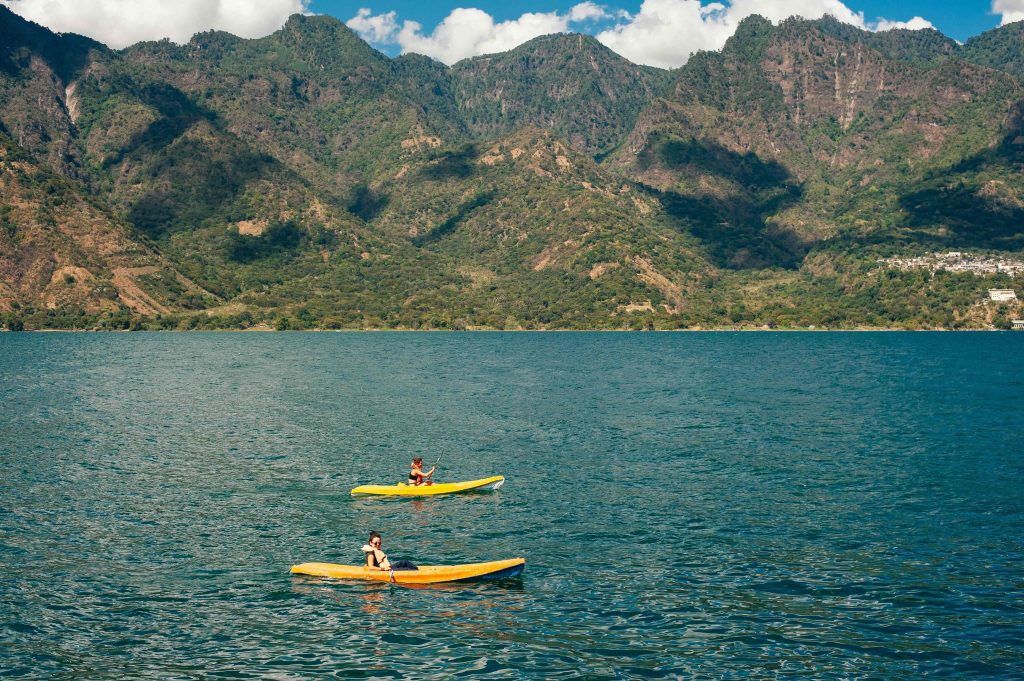
Kayak and Hike from Panajachel
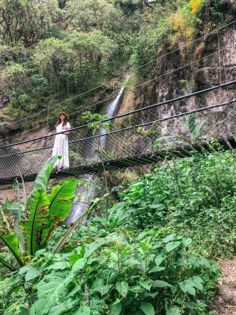
You start on the lake by kayak, paddling from Panajachel along the northern shore, and then switch to a trail walk, ending back at the water. It’s a good half-day combination that shows you the lake at two different scales: reading it horizontally from the water, then from above as you climb. Go before noon. The Xocomil wind picks up in the afternoon and makes open-lake kayaking significantly harder. The kayak and hike adventure from Panajachel handles the equipment and the route.
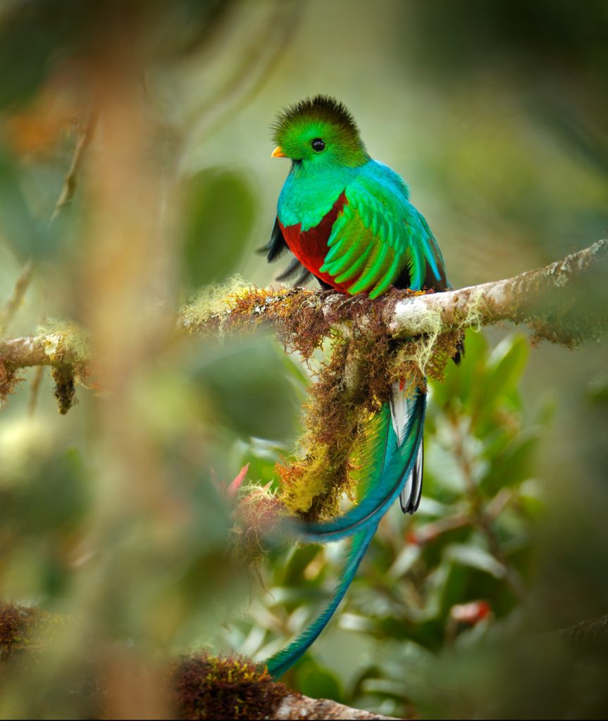
Quetzal Quest: Birdwatching at Rey Tepepul
If seeing a resplendent quetzal is on your list, Rey Tepepul above Santiago Atitlán is one of the lake’s documented quetzal habitats and one of the most accessible places to try for a sighting near the water. The Quetzal Quest birdwatching adventure at Rey Tepepul pairs the trail to the lookout with a birding guide who knows the species and behavior of what lives in that forest. First light is essential. Go early. If birding across Guatemala is what you’re after, my Guatemala birding guide covers all the major destinations including Ranchitos del Quetzal in the Verapaces.
Reserva Natural de Atitlán, Panajachel
The former coffee plantation on the edge of Panajachel is where I’d send anyone who wants a morning of nature without any of the elevation commitment. Hanging bridges, a spider monkey platform, a butterfly enclosure, a waterfall, and at the end of the main trail a private beach that most visitors never reach because they turn back too soon. Q80 entrance. The ziplines and the aerial cable bike (the only one in Guatemala) cost extra and are worth it. I have a full published review at Visiting the Reserva Natural de Atitlán that covers everything including the overnight experience, which most people don’t know is an option. You can also check the trail on AllTrails before you go.
FOR SERIOUS TREKKERS
Xela to Lake Atitlán: The Multi-Day Highland Trek
Most people arrive at Lake Atitlán by shuttle or chicken bus. There’s another way: three days on foot from Quetzaltenango through the western highlands. From Guatemala’s second city, the route crosses indigenous K’iche’ and Kaqchikel Maya communities, cloud forest, and coffee-growing country before descending to the lake basin. On the third morning, before dawn, you’re hiking by headlamp toward the Indian Nose for sunrise. When the lake appears below you after two days of walking to get there, it means something different than it would from a tourist van.
The route passes through communities that the standard Guatemala tourist itinerary bypasses completely. You stay in basic village hospedajes (Q50-150 per night depending on what’s available), eat where the locals eat, and experience the highlands as an agricultural and cultural landscape that Maya communities have shaped for centuries, not as scenery. The guide isn’t a formality here. Without language and local connections, the villages you walk through become backdrop rather than destination. The main public operator for this route is Quetzaltrekkers, a nonprofit based in Xela that puts all proceeds toward children’s education. They run on Tuesdays and Saturdays only, so plan your Xela days around that. If you want a private guide with deeper community connections along the route, that’s something I help with through my planning service.
📌 PRACTICAL NOTES — XELA TO LAKE ATITLÁN
Three days is typical. Plan to arrive in Xela a day early. Quetzaltrekkers requires a mandatory pre-trek meeting the evening before departure. The route varies depending on your guide and conditions. Budget Q50-150 per night for basic village accommodation. The final descent to the lake on day three is worth every step of the two days before it.
BEFORE YOU GO
What You Need to Know Before You Hike
On guides, and why it matters on certain trails
The four volcano hikes and the Indian Nose sunrise all require a licensed local guide, both by INGUAT regulation and by actual practical necessity, since the trails aren’t marked and the upper sections change with conditions. On those specific routes, going without a guide is also a safety risk. There have been robberies on unguided approaches, particularly on the Indian Nose pre-dawn trail and on the volcano routes. It’s not a theoretical concern. Book with a registered operator and don’t try to improvise these ones.
Everything else in this guide: the shoreline trail between Santa Cruz and Jaibalito, the Reserva Natural, Cerro Tzankujil, Tzununá waterfall, Cascadas Palopó, Catarata Sajbina. You can do all of those completely on your own. The guided options for the cultural walks (Lower Mayan Trail, Ancestral Mayan Walk, Santa Cruz to San Marcos) are recommended because the guide is what makes those experiences meaningful, not because you’d be unsafe without one.
⚠ THE ALTITUDE IS REAL
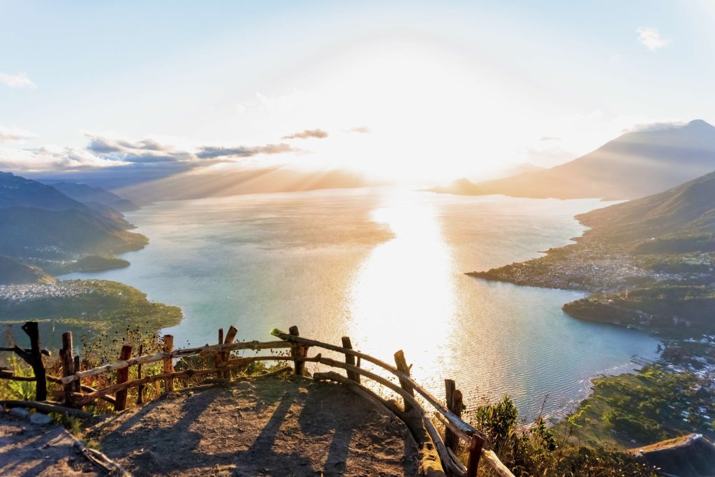
The lake sits at 1,562 meters. The volcano summits reach 3,020 to 3,537 meters. That’s a significant elevation gain even before you start hiking, and it affects people differently. Hydrate well the day before any summit hike. Bring a warm layer regardless of how warm it feels at the dock. It can be 10 to 15 degrees colder at the top. And go early. Cloud cover typically builds between 9 and 11 AM and closes the summit views you’re there for. A 5 to 6 AM start is not optional on any volcano hike.
What to bring
For any hike at the lake: more water than you think you’ll need (minimum 2 liters for anything over 2 hours), sunscreen, a hat, and shoes with grip. For the volcano summits add a warm layer, rain gear if you have it, and extra food. For the waterfall hikes bring water shoes or sturdy sandals and a change of clothes. During rainy season (May-October) the unpaved waterfall approaches get slippery. Factor that into your assessment of difficulty.
Before You Book These Hikes
I Know Who to Call for These Trails
I’ve been hiking these routes with Timoteo for years, and I’ve sent a lot of people his way. He’s from one of the small villages at the top of the mountain above the lake, which is exactly why these paths make sense with him rather than without him. The safety concerns in this article aren’t filler. His contact is something I share personally. Get in touch and I’ll pass it along.
WHERE TO STAY
Where to Base Yourself for Each Hike
The right base depends on which trails you’re prioritizing. Each of my village guides has a complete hotel section. Here’s the short version.
Volcán San Pedro, Indian Nose, and Waterfall Hike: stay in San Pedro
Closest to the trailheads and where most operators pick up for these hikes. Full hotel options in my San Pedro La Laguna guide.
Northern shore trails (Santa Cruz, Jaibalito, Tzununá): stay in Santa Cruz, San Marcos, or Tzununá
Santa Cruz and Tzununá have small eco-lodges. La Casa del Mundo sits between Jaibalito and Santa Cruz: hot tub with lake views, kayaking, family-style dinners, boat-access only. San Marcos has the widest range on the northern shore. Full options in my San Marcos guide.
Reserva Natural, Lower Mayan Trail, Kayak and Hike: stay in Panajachel
All three depart from or near Panajachel. Staying overnight at the Reserva Natural itself is the most unusual option, surrounded by forest and wildlife rather than the town. Full options in my Reserva Natural review and my Panajachel guide.
Volcán Tolimán, Volcán Atitlán, Catarata Sajbina, Cascadas Palopó: access from the eastern shore
Santiago Atitlán is the closest base for the Tolimán and Atitlán hikes. San Lucas Tolimán has basic accommodation for Catarata Sajbina; most people day-trip from Panajachel or San Pedro by lancha (about 40 minutes). Full Santiago options in my Santiago Atitlán guide.
A rental car opens up the eastern shore road. Cascadas Palopó, San Lucas Tolimán for Catarata Sajbina, the approach to Santiago Atitlán: you reach all of those on your own schedule without depending on lancha times. It’s also the right move if you’re connecting from the lake to Quetzaltenango for the Xela trek. My Guatemala car rental guide covers the full picture.

Planning Your Lake Hiking Days
I Know Which Combinations Are Worth Your Mornings
Most visitors do one hike and leave a lot on the table. I know how to stack a lake itinerary around the trails that are worth the early alarm, and which ones sound better than they actually are. Get in touch and let’s talk through what fits your schedule.
QUESTIONS PEOPLE ASK
Hiking Lake Atitlán: Your Questions Answered
Can you hike around Lake Atitlán?
Partially. The northern shore between Santa Cruz, Jaibalito, Tzununá, and San Marcos can be walked on connected village paths. The Santa Cruz to San Marcos trail covers this section in 3 to 4 hours. The southern and eastern shores are much less established and don’t have consistent paths connecting all villages. A full circumnavigation isn’t a marked or standard route. The northern shore walk is the main long-distance option and it’s excellent.
What is the difficulty of hiking Atitlán?
It covers everything. Easy: the Reserva Natural trails (family-friendly, 1-3 hours), Cerro Tzankujil forest walk (Q20, easy terrain), Santa Cruz to Jaibalito (mostly flat, 1.5-2 hours). Moderate: Tzununá waterfall (40-60 minutes uphill), Indian Nose (steep in sections, pre-dawn, 2-3 hours). Hard: Volcán San Pedro (4-6 hours, significant elevation), Volcán Tolimán (7-8 hours, rated hard). Very strenuous: Volcán Atitlán (1,600m of elevation gain, 8+ hours). Keep in mind that the lake base is already at 1,562 meters, so even the easier hikes feel more demanding than they would at sea level.
Is the Indian Nose hike safe?
With a guide from a registered operator, yes. Without one, there have been robberies on this trail and that’s not something I’d risk for a hike that costs very little to do properly. Book the tour every time. Don’t try to improvise the pre-dawn approach on your own.
Is there a hike from Xela (Quetzaltenango) to Lake Atitlán?
Yes, and it’s one of the best ways to arrive at the lake. A 3-day trek from Quetzaltenango through the indigenous highland villages and cloud forest descends to the Lake Atitlán basin on the final day. The public nonprofit operator is Quetzaltrekkers, which runs Tuesdays and Saturdays. For a private guide with deeper local connections, get in touch. The full route description is in the section above.
What is the best time of year to hike at Lake Atitlán?
November through April gives you the clearest mornings, the most reliable summit views, and drier trail conditions on the unpaved waterfall and village routes. During rainy season (May-October) the upland trails get slippery and summit views are often obscured by afternoon cloud. That said, the highlands are beautiful in the rains. Start early and accept that the summit might be in cloud by the time you reach it. The window of clear light, regardless of season, is 5 to 9 AM.
EXPLORE THE LAKE
Village Guides and Related Reading
|
VOLCANO BASE CAMP San Pedro La Laguna: Best Hikes, Restaurants, and Nightlife The complete guide to the lake’s most active village, and where to stay for San Pedro volcano, Indian Nose, and the waterfall hike. |
NORTHERN SHORE TRAILS San Marcos La Laguna: What to Do and What to Skip Cerro Tzankujil, cliff jumping, yoga, and the full honest guide to the village that anchors the northern shore walk. |
|
PANAJACHEL-BASED HIKES Visiting the Reserva Natural de Atitlán My full published review covering every trail, the ziplines, the aerial cable bike, overnight option, and the private beach at the end of the trail. |
EASTERN SHORE HIKES Santiago Atitlán: Culture, History, and What to Know Your base for Volcán Tolimán, Volcán Atitlán, and the Quetzal Quest at Rey Tepepul, and the most culturally significant village at the lake. |
|
THE COMPLETE LAKE Lake Atitlán Guatemala: Complete Guide to Every Village Every village, the boat system, where to stay, and how to plan the full lake experience. |
GETTING BETWEEN TRAILHEADS Complete Guide to Lake Atitlán Boat Services Every route, dock, timing, and price for moving between villages. Essential if you’re doing multiple hikes across different shores. |
|
BIRDING IN GUATEMALA Birds of Guatemala: A Guide to the Best Birding Destinations Where to find quetzals and the country’s most important birding sites beyond Rey Tepepul at the lake. |
PLANNING YOUR TRIP Best Things to Do in Guatemala How the lake’s hikes fit into a wider Guatemala trip alongside Antigua, Tikal, and the Pacific coast. |
This Lake Is My Country
I’ve Hiked Every Trail on This List. Let Me Help You Choose the Right Ones.
These aren’t trails I researched for an article. I’ve done them with my kids, with friends visiting from the US, alone at dawn before anyone else was moving. If you want help making the most of your time at this lake, get in touch before you finalize your plans.
Get up before the clouds form. Be on the trail while the lake is still. That’s when this place gives you what it actually is. Not the postcard version. The real one.
Through her writing, Paula helps travelers discover Guatemala beyond the typical tourist route with practical advice, local recommendations, and authentic experiences that connect visitors with the country’s people, culture, and traditions.
Planning a trip to Guatemala? Paula offers personalized Guatemala itinerary planning and trip consultation services tailored to your interests, travel style, and budget. Contact her at [email protected] to learn more.
- Hotel Casa Realeza Antigua Guatemala Review: Stay by La Merced - July 21, 2026
- Best Restaurants in Panajachel: Where to Eat in Pana - July 21, 2026
- Traditional Foods of Sololá: What to Eat Around Lake Atitlán - July 20, 2026

